

|
|
| Mesoscale Discussion 702 | |
| Next MD > | |
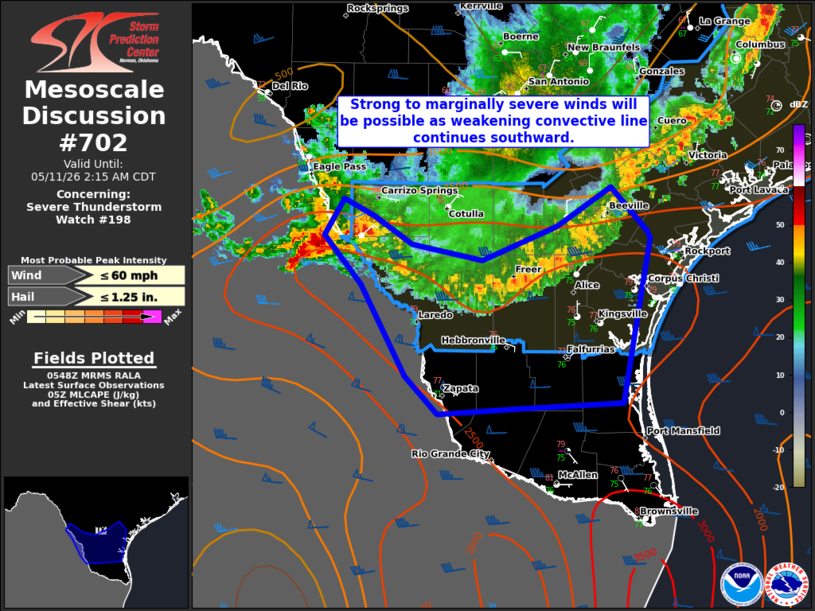 | |
Mesoscale Discussion 0702 NWS Storm Prediction Center Norman OK 1250 AM CDT Mon May 11 2026 Areas affected...Deep South Texas Concerning...Severe Thunderstorm Watch 198... Valid 110550Z - 110715Z The severe weather threat for Severe Thunderstorm Watch 198 continues. SUMMARY...Isolated strong to marginally severe wind gusts will remain possible in Deep South Texas. Given weakening trends observed over the last hour, a downstream watch is not anticipated. DISCUSSION...Both lightning and radar trends have shown a general decrease in intensity of convection moving into Deep South Texas. Recent observed wind gusts with a surging portion of the convective line from George West/Beeville have been 32-38 kt. As this line continues southward, MLCIN will remain relatively low given the mid/upper 70s F dewpoints. Occasionally strong/marginally severe gusts could occur in an isolated sense. Larger buoyancy resides near the Rio Grande. Stronger cells within the valley could also produce damaging gusts and perhaps large hail. Given the observed trends, a downstream watch is not anticipated. ..Wendt.. 05/11/2026 ...Please see www.spc.noaa.gov for graphic product... ATTN...WFO...CRP...EWX...BRO... LAT...LON 27810001 28200036 28510017 28379990 28139955 28009889 28299820 28609771 28259738 28189735 27319752 26849761 26809852 26759930 27069960 27810001 MOST PROBABLE PEAK WIND GUST...UP TO 60 MPH MOST PROBABLE PEAK HAIL SIZE...UP TO 1.25 IN | |
| Top/All Mesoscale Discussions/Forecast Products/Home | |