

|
|
| Mesoscale Discussion 701 | |
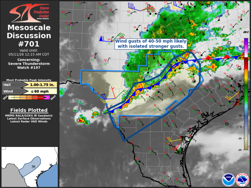 | |
Mesoscale Discussion 0701 NWS Storm Prediction Center Norman OK 0951 PM CDT Sun May 10 2026 Areas affected...south-central Texas Concerning...Severe Thunderstorm Watch 197... Valid 110251Z - 110515Z The severe weather threat for Severe Thunderstorm Watch 197 continues. SUMMARY...A few severe wind gusts remain possible as activity spreads south/southeast. Isolated large hail may occur toward the lower Rio Grande Valley. DISCUSSION...Storms continue to propagate southeastward across central TX and toward the Rio Grande Valley as the aggregate outflow/cold front pushes south. Surface observations have generally shown gusts of 35 to 50 mph, and this is generally expected as storms affect the I-35 corridor. Toward the Rio Grande, sporadic upticks in intensity have been noted, though the southern portion of this line/outflow has not yet consolidated into an MCS. This scenario remains possible over the next several hours as the air mass remains very moist and unstable. Depending on storm trends, a watch could be needed for parts of Deep South TX for wind & hail potential. ..Jewell.. 05/11/2026 ...Please see www.spc.noaa.gov for graphic product... ATTN...WFO...HGX...FWD...CRP...EWX... LAT...LON 28850059 29169989 29839947 29949885 30159839 30739785 31019723 30949700 30529667 29879670 29379715 28729808 27719990 28090009 28250029 28700052 28850059 MOST PROBABLE PEAK WIND GUST...UP TO 60 MPH MOST PROBABLE PEAK HAIL SIZE...1.00-1.75 IN | |
| Top/All Mesoscale Discussions/Forecast Products/Home | |