

|
|
| Mesoscale Discussion 675 | |
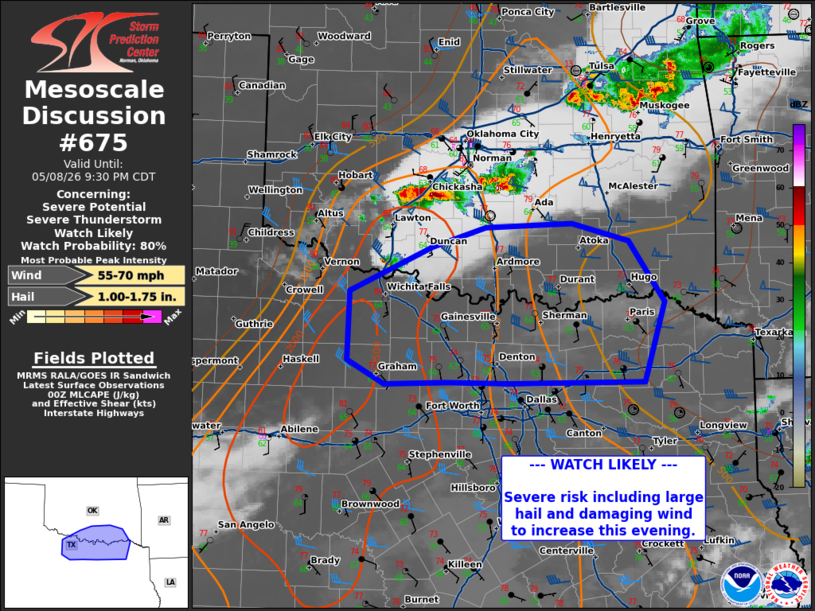 | |
Mesoscale Discussion 0675 NWS Storm Prediction Center Norman OK 0729 PM CDT Fri May 08 2026 Areas affected...north-central Texas Concerning...Severe potential...Severe Thunderstorm Watch likely Valid 090029Z - 090230Z Probability of Watch Issuance...80 percent SUMMARY...Thunderstorm activity will move southward across the Red River into north-central Texas this evening. Additional thunderstorm development will be possible south of the Red River north of the DFW Metro. DISCUSSION...A broken line of thunderstorms continues to move south and east across portions of central Oklahoma. This is tending to cluster along outflow but embedded supercells are still producing occasional hail up to 1.75-2.75 inches. Through time, this will continue to evolve into a greater damaging wind threat as it moves into north Texas this evening given trends in growth along outflow. Temperatures downstream are cooling, with temperatures in the mid to upper 70s. The 00z sounding from FWD shows less favorable low levels but does show a deep layer of instability aloft. Upper level flow remains modest but downward momentum transport from heavier cores may produce severe caliber winds. A watch will likely be needed downstream of WW192 soon. ..Thornton/Guyer.. 05/09/2026 ...Please see www.spc.noaa.gov for graphic product... ATTN...WFO...SHV...TSA...FWD...OUN... LAT...LON 33949892 34399792 34599727 34639622 34449552 33839509 33029534 33019698 33029775 33009849 33249894 33949892 MOST PROBABLE PEAK WIND GUST...55-70 MPH MOST PROBABLE PEAK HAIL SIZE...1.00-1.75 IN | |
| Top/All Mesoscale Discussions/Forecast Products/Home | |