|
|
| Mesoscale Discussion 707 | |
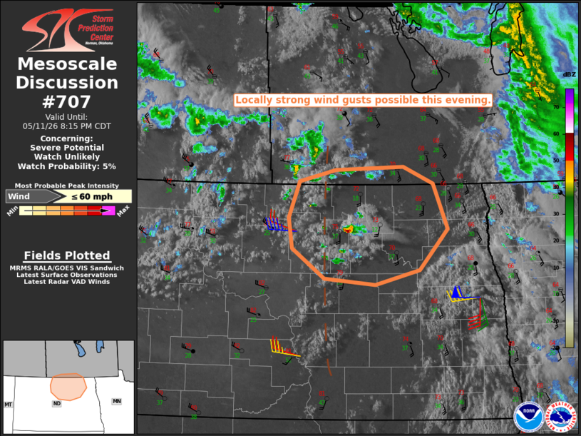 | |
   Mesoscale Discussion 0707
   NWS Storm Prediction Center Norman OK
   0642 PM CDT Mon May 11 2026

   Areas affected...north-central and northeast North Dakota

   Concerning...Severe potential...Watch unlikely

   Valid 112342Z - 120115Z

   Probability of Watch Issuance...5 percent

   SUMMARY...The potential for locally strong wind gusts will exist
   with any deeper convective elements through about 01z. A watch is
   not anticipated.

   DISCUSSION...A small thunderstorm has recently developed over
   McHenry into Pierce Counties along a surface trough, where a narrow
   axis of locally higher moisture content exists. The moisture
   combined with a plume of very steep, low/mid-level lapse rates is
   resulting in estimated MUCAPE of 250-500 J/kg. Forecast soundings
   suggest that the ambient environment features a deeply mixed
   boundary layer extending upwards of 3 km, where westerly winds of
   30-40 kt exist. As such, there appears to be some potential for
   locally strong wind gusts for the next couple or hours with any
   deeper convective elements before the boundary layer begins to cool
   and stabilize.

   ..Mead/Gleason.. 05/11/2026

   ...Please see www.spc.noaa.gov for graphic product...

   ATTN...WFO...FGF...BIS...

   LAT...LON   48170095 47770032 47699932 47889846 48419792 49009820
               49239878 49180009 49040081 48560101 48170095

   MOST PROBABLE PEAK WIND GUST...UP TO 60 MPH
| |
| Top/All Mesoscale Discussions/Forecast Products/Home | |