

|
|
| Mesoscale Discussion 690 | |
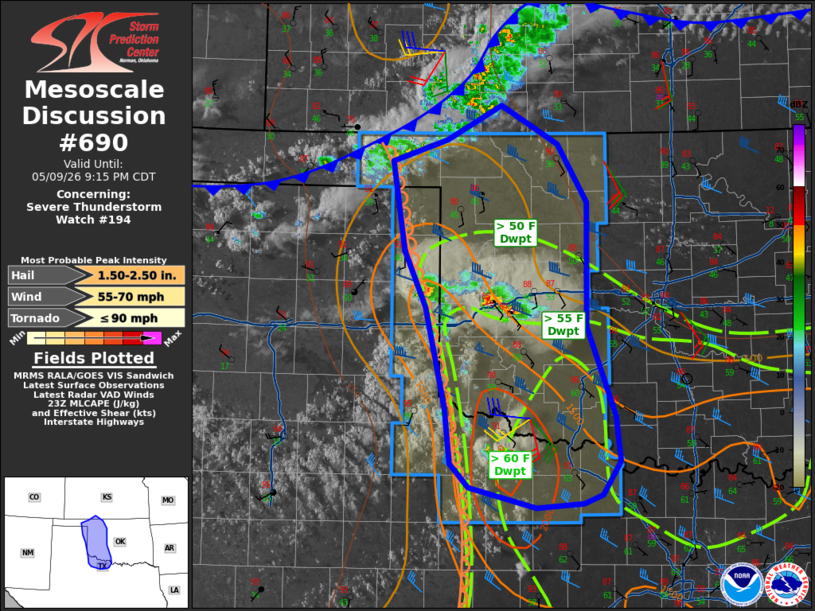 | |
Mesoscale Discussion 0690 NWS Storm Prediction Center Norman OK 0619 PM CDT Sat May 09 2026 Areas affected...western Oklahoma...far eastern Texas Panhandle and northwest Texas Concerning...Severe Thunderstorm Watch 194... Valid 092319Z - 100215Z The severe weather threat for Severe Thunderstorm Watch 194 continues. SUMMARY...Large hail threat persists into western Oklahoma and northwest Texas. A few damaging gusts may develop anywhere within the watch. DISCUSSION...Several supercells currently extend from the eastern TX Panhandle into west-central OK, with reports from 1.50" to 2.01" diameter. These cells are interacting with the moisture/instability axis while the boundary layer remains near peak heating. Midlevel west/northwest winds of 40 kt atop backed/southeasterly surface winds are creating favorable shear profiles to support the hail cells, and the increasing low-level jet may enhance inflow and rightward motion later this evening before inhibition increases. Farther north, a line of high-based convection persists from central KS into the OK Panhandle, where dewpoints are only in the 30s and 40s F. However, an increasing low-level jet this evening will bring 50s F dewpoints northward into the area, possibly supporting a degree of strengthening along any existing outflow surge. ..Jewell.. 05/09/2026 ...Please see www.spc.noaa.gov for graphic product... ATTN...WFO...OUN...DDC...LUB...AMA... LAT...LON 33939988 34469993 35380016 35900040 36560050 36740054 36949992 37269930 36909865 36359833 35219834 34379802 33959797 33659817 33569838 33539891 33729966 33939988 MOST PROBABLE PEAK TORNADO INTENSITY...UP TO 90 MPH MOST PROBABLE PEAK WIND GUST...55-70 MPH MOST PROBABLE PEAK HAIL SIZE...1.50-2.50 IN | |
| Top/All Mesoscale Discussions/Forecast Products/Home | |