

|
|
| Mesoscale Discussion 678 | |
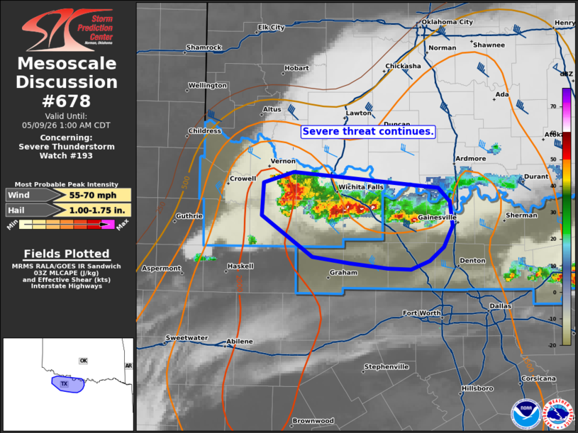 | |
Mesoscale Discussion 0678 NWS Storm Prediction Center Norman OK 1100 PM CDT Fri May 08 2026 Areas affected...portions of north-central Texas Concerning...Severe Thunderstorm Watch 193... Valid 090400Z - 090600Z The severe weather threat for Severe Thunderstorm Watch 193 continues. SUMMARY...Threat for instances of severe hail and damaging wind continues within WW193. DISCUSSION...A line of storms continues southward across portions of north-central Texas just south of the Red River and Wichita Falls. Outflow has moved outward from this cluster but a few intense cores remain (with tops around 40-45 kft). It is likely that nocturnal boundary layer decoupling has occurred given lack of wind reports. However, a few instances of severe hail and strong to severe wind may persist over the next 1-2 hours. ..Thornton.. 05/09/2026 ...Please see www.spc.noaa.gov for graphic product... ATTN...WFO...FWD...OUN... LAT...LON 34099898 33999931 33699934 33309877 33249834 33189791 33179765 33269745 33389728 33599719 33819722 33959735 34099898 MOST PROBABLE PEAK WIND GUST...55-70 MPH MOST PROBABLE PEAK HAIL SIZE...1.00-1.75 IN | |
| Top/All Mesoscale Discussions/Forecast Products/Home | |