|
|
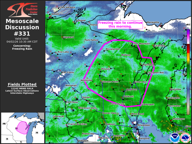
| Mesoscale Discussion 331 | |
 | |
   Mesoscale Discussion 0331
   NWS Storm Prediction Center Norman OK
   0727 AM CDT Thu Apr 02 2026

   Areas affected...central and northeast Wisconsin

   Concerning...Freezing rain

   Valid 021227Z - 021530Z

   SUMMARY...Freezing rain will continue this morning across portions
   of central and northeast Wisconsin.

   DISCUSSION...Moderate to heavy freezing rain continues across
   central and northeast Wisconsin this morning. Several ASOS/AWOS
   sites have measured around 0.25" of ice accretion in the past 6
   hours with 1 hour totals up to 0.1". Strengthening low-level
   east-northeasterly flow should maintain below freezing surface
   temperatures across this region this morning. Given the upstream
   radar mosaic, expect similar ice accretion rates for at least a few
   more hours, especially across northeast Wisconsin where temperatures
   remain in the upper 20s and the heaviest precipitation should last
   longer.

   ..Bentley.. 04/02/2026

   ...Please see www.spc.noaa.gov for graphic product...

   ATTN...WFO...MQT...GRB...MKX...ARX...

   LAT...LON   43768770 43718840 43948930 44359020 44649043 45029017
               45568974 45848945 46008905 45998853 45968817 45878785
               45638771 45418761 45378718 45038705 43768770
| |
| Top/All Mesoscale Discussions/Forecast Products/Home | |