root@sleepynerdlive.com
:
~
$
cat $HOME/public_html/posts/storm-prediction-center-mesoscale-discussion-2260.txt >> story.html | parse_story story.html; rm -f storm-prediction-center-mesoscale-discussion-2260.txt story.html
|
|
| Mesoscale Discussion 2260 | |
|
|
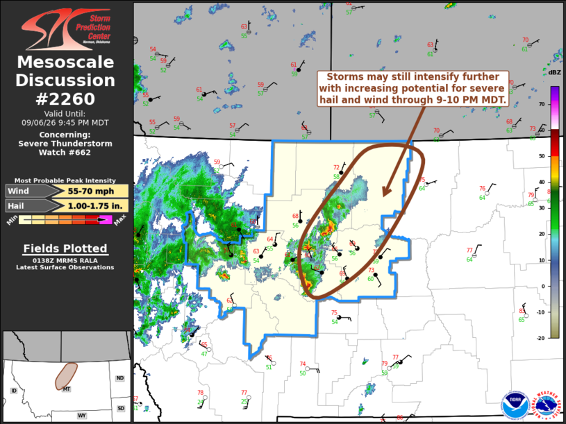
Mesoscale Discussion 2260 NWS Storm Prediction Center Norman OK 0841 PM CDT Sun Sep 06 2026 Areas affected...parts of north central Montana Concerning...Severe Thunderstorm Watch 662... Valid 070141Z - 070345Z The severe weather threat for Severe Thunderstorm Watch 662 continues. SUMMARY...Thunderstorms may still intensify as they approach areas to the southwest and west of Glasgow through 9-10 PM MDT, accompanied by increasing potential for large hail and localized severe wind gusts. DISCUSSION...Storms thus far have remained fairly small in size and of modest intensity, with cells tending to propagate with the south-southwesterly cloud-bearing layer mean flow (on the order of 30 kt). Through 03-04Z, ongoing cells to the west through north-northwest of Lewistown may still acquire more substantively unstable updraft inflow as they propagate into areas near and southwest through west of Glasgow, where post-frontal surface dew points remain in the lower to mid 60s F, perhaps supporting CAPE as high as 2000 J/kg. ..Kerr.. 09/07/2026 ...Please see www.spc.noaa.gov for graphic product... ATTN...WFO...GGW...TFX... LAT...LON 47511061 48420978 48920906 48720797 47470889 46870980 46771043 47511061 MOST PROBABLE PEAK WIND GUST...55-70 MPH MOST PROBABLE PEAK HAIL SIZE...1.00-1.75 IN |
|
|
Top/All Mesoscale Discussions/Forecast Products/Home |
|